


Voting District 0027, Wise County, Texas
About
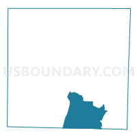
Outline

Summary
| Unique Area Identifier | 678333 |
| Name | Voting District 0027 |
| County | Wise County |
| State | Texas |
| Area (square miles) | 65.39 |
| Land Area (square miles) | 64.51 |
| Water Area (square miles) | 0.87 |
| % of Land Area | 98.66 |
| % of Water Area | 1.34 |
| Latitude of the Internal Point | 33.04194200 |
| Longtitude of the Internal Point | -97.59708260 |
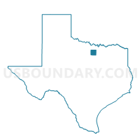
Maps

Graphs
Select a template below for downloading or customizing gragh for Voting District 0027, Wise County, Texas


Neighbors
Neighoring Voting District (by Name) Neighboring Voting District on the Map
- Voting District 0002, Wise County, TX
- Voting District 0008, Wise County, TX
- Voting District 0017, Wise County, TX
- Voting District 0020, Wise County, TX
- Voting District 0024, Wise County, TX
- Voting District 0025, Wise County, TX
- Voting District 0115, Parker County, TX
- Voting District 0125, Parker County, TX
- Voting District 4371, Tarrant County, TX
- Voting District 4394, Tarrant County, TX
Top 10 Neighboring County Subdivision (by Population) Neighboring County Subdivision on the Map
- Fort Worth CCD, Tarrant County, TX (791,745)
- Springtown-Reno CCD, Parker County, TX (37,832)
- Bridgeport CCD, Wise County, TX (21,446)
- Boyd-Rhome CCD, Wise County, TX (18,608)
- Decatur CCD, Wise County, TX (16,176)
Top 10 Neighboring Place (by Population) Neighboring Place on the Map
- Briar CDP, TX (5,665)
- Pecan Acres CDP, TX (4,099)
- Springtown city, TX (2,658)
- Rhome city, TX (1,522)
- Aurora city, TX (1,220)
- Boyd town, TX (1,207)
Top 10 Neighboring Unified School District (by Population) Neighboring Unified School District on the Map
- Eagle Mountain-Saginaw Independent School District, TX (79,354)
- Northwest Independent School District, TX (75,819)
- Azle Independent School District, TX (36,509)
- Springtown Independent School District, TX (18,468)
- Boyd Independent School District, TX (5,766)
- Paradise Independent School District, TX (4,840)
Top 10 Neighboring State Legislative District Lower Chamber (by Population) Neighboring State Legislative District Lower Chamber on the Map
Top 10 Neighboring State Legislative District Upper Chamber (by Population) Neighboring State Legislative District Upper Chamber on the Map
Top 10 Neighboring 111th Congressional District (by Population) Neighboring 111th Congressional District on the Map
Top 10 Neighboring Census Tract (by Population) Neighboring Census Tract on the Map
- Census Tract 1506.01, Wise County, TX (7,962)
- Census Tract 1141.04, Tarrant County, TX (6,844)
- Census Tract 1501.02, Wise County, TX (6,569)
- Census Tract 1506.02, Wise County, TX (6,459)
- Census Tract 1404.05, Parker County, TX (6,443)
- Census Tract 1404.03, Parker County, TX (6,223)
- Census Tract 1142.03, Tarrant County, TX (5,491)
- Census Tract 1506.03, Wise County, TX (4,187)
- Census Tract 1504.03, Wise County, TX (3,757)
Top 10 Neighboring 5-Digit ZIP Code Tabulation Area (by Population) Neighboring 5-Digit ZIP Code Tabulation Area on the Map
- 76179, TX (48,058)
- 76020, TX (27,270)
- 76082, TX (17,748)
- 76234, TX (15,587)
- 76078, TX (8,572)
- 76023, TX (5,832)
- 76073, TX (5,327)
- 76071, TX (3,320)